Copyright 2026 Lake State Land Surveying.
(906) 451-3025 | Request Proposal
PO Box 533; Iron Mountain, MI 49801
Website design by North Country Website Design↗.


Defining boundaries since 2014.


LAKE STATE LAND SURVEYING
Professional Land Surveying Services
Our owners Brad Andresen and Andy Buck will work directly with you on your surveying project from survey quote, to legal research, field work and finally the survey map or deliverables. Brad and Andy have over 30 years of combined surveying experience in all aspects of land surveying.
BOUNDARY SURVEY
(LOT SURVEY)
LAND DIVISION SURVEY
A Boundary Survey establishes the location of property
lines for a parcel of land as described in a deed. This
involves the research of publicly recorded documents, a
search for existing survey monumentation, precise field
measurements, office computations and placement of
permanent survey monuments to reference the location
of the property corners (if not already marked and
accepted in the correct location). A “Certificate of
Survey” is prepared for the client's personal records
documenting and certifying the results of the survey.
Services that can be bundled while performing a
Boundary Survey include:
•
Accurately locating the property lines on the ground
with wood or metal fence post type stakes.
•
Brushing out the lines with chainsaws if lines are in
rural woods setting.
•
Setting custom survey monuments or carsonite
markers at the corners of along the property lines.
•
Wooden survey stakes or hardwood lath can be
placed at requested intervals along property lines.
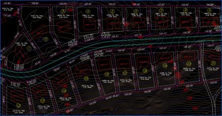
A Land Division Survey is a legal survey required when
you are splitting an existing parcel into two or more new
legal parcels or when an exchange of land between
adjacent parcels to change its configuration. State
subdivision rules and local municipality rules govern
how many times an existing parcel can be subdivided.
Local zoning regulations also need to be considered
when splitting or combining a parcel of land.
•
In Michigan the most common way to divide land
falls under Public Act 132 of 1970.
•
In Wisconsin the most common way to divide land
falls under Chapter 236 of the Wisconsin Statutes.
SUBDIVISION PLAT or
CONDOMINIUM PLAT
Subdivision and Condominium Plats are used to divide
land into pieces that are easier to sell or otherwise
develop. A Subdivision may be for the purpose of
housing or commercial and industrial development.
Subdivisions and Condominiums share many
similarities but also have specific uses for both the
developer and the potential buyer of the lots within
them. The largest difference between a Condominium
Plat and a Subdivision Plat is the process for review,
approval and recording.
EASEMENT SURVEY /
PREPARATION
Easement Preparation is needed if you are planning to
grant your adjoining property owner, utility company,
municipality, etc., an easement or right-of-way to access
your property, install utilities, maintain structures, use
water courses, etc. You could also be in need of an
easement or right-of-way for access to your parcel.
This survey/service can be accomplished by the
preparation of an “Easement Description” and should
be accompanied with an “Exhibit” for recording at your
county's register of deeds office.
ELEVATION CERTIFICATE
(FLOOD CERTIFICATE)
The Elevation Certificate provides information for
insurance companies, lenders and community flood
control administrators. This information is required to
estimate the risks for flooding. Elevation Certificates are
required by the National Flood Program which is
administered by the Federal Emergency Management
Agency (FEMA). This certification is required in areas
which have been identified as having a potential for
flooding.
In March of 2009, FEMA made updates to flood zones
and maps in many areas. Due to this change, many
areas that were previously not in an area considered a
flood zone are now marked as such. In some cases it is
possible that an area within a special flood zone is
actually higher than the base flood elevation. In such
case, FEMA allows for a single lot letter of Map
Amendment to take a lot or a subdivision out of the
flood plain. The land owner must prove that the natural
elevations in that area were incorrect and that the
property is higher than the base flood elevation in the
area. The findings will be reflected on future flood
maps. The LOMA may reduce insurance costs. FEMA
also allows for a Letter of Map Revision in the event that
some type of change to the land has occurred and the
elevation has risen.
Learn how we can reduce or eliminate the cost
of your flood insurance.
CONSTRUCTION LAYOUT
Construction Stakeout provides for the placement of
survey stakes at reference points to aid in the
construction of proposed site improvements. Stakes can
be placed to reference proposed grade, building corners,
utility locations, etc.
Services we support include construction layout &
staking, as-builts, earthwork quantity determinations
and grade staking. We can also prepare job specific
QA/QC documentation and a statement of qualifications
for contractors to submit for proposal purposes.
TOPOGRAPHIC SURVEY
(TOPO)
Topographic surveys establish the different manmade
and the natural features of land. This type of survey can
be very beneficial to home owners, industrial owners, or
even for properties under construction. Land features
may include hills, trees, fences, water wells, buildings
and other improvements. A topographical survey will
provide exact figures of the size, height and position of
different changes that have occurred over the course of
time with regard to their presence or that of any man
made structures.
ALTA TITLE SURVEY
An ALTA survey is a boundary survey prepared to a set
of minimum standards that have been jointly prepared
and adopted by the ALTA/ACSM. Additionally, an
ALTA survey shows improvements, easements, rights-
of-way, and other elements impacting the ownership of
land. An ALTA Survey is often prepared for commercial
properties, as it will provide the title company with the
information required to insure the title to the land and
improvements to the high degree that a commercial
development may require. In addition to the minimum
standards set forth, a table of optional elements is
included in the ALTA/ACSM standards. A careful
review of the elements from the optional "Table A" is
helpful in delineating a clear scope of the land
surveyor's services.
A current title commitment is required before an ALTA
Survey can be completed. The surveyor will refer to the
title commitment for the legal description of the
property and for the legal description of any
encumbrances (exceptions). Areas of ownership,
improvements, and encumbrances will be shown
graphically. If the survey discovers any encroachments,
they should be shown graphically, and a note indicating
the nature of the encroachment may also be added.
The certification language of the ALTA Survey should
include the names of the affected parties, including as
appropriate the buyer, seller, title company, and lender.
The surveyor must work in close association with the
title insurance company, as the surveyor and the title
company are relying on each other's work to show the
matters affecting the ownership of the land and
improvements in a comprehensive manner.
An ALTA land survey has especially stringent
requirements as developed by a joint effort of the
American Land Title Association and the American
Congress on Surveying and Mapping. The ALTA
standards are a nationwide uniform set of standards.
Copyright 2026 Lake State Land Surveying.
(906) 451-3025 | Request Proposal
PO Box 533; Iron Mountain, MI 49801
Website design by North Country Website Design↗.


Defining boundaries since 2014.
Professional Land
Surveying Services
Our owners Brad Andresen and Andy Buck will work directly with you on your surveying project from survey quote, to legal research, field work and finally the survey map or deliverables. Brad and Andy have over 30 years of combined surveying experience in all aspects of land surveying.BOUNDARY SURVEY
(LOT SURVEY)
LAND DIVISION SURVEY
A Boundary Survey establishes the location of property
lines for a parcel of land as described in a deed. This
involves the research of publicly recorded documents,
a search for existing survey monumentation, precise
field measurements, office computations and
placement of permanent survey monuments to
reference the location of the property corners (if not
already marked and accepted in the correct location).
A “Certificate of Survey” is prepared for the client's
personal records documenting and certifying the
results of the survey.
Services that can be bundled while performing a
Boundary Survey include:
•
Accurately locating the property lines on the
ground with wood or metal fence post type stakes.
•
Brushing out the lines with chainsaws if lines are in
rural woods setting.
•
Setting custom survey monuments or carsonite
markers at the corners of along the property lines.
•
Wooden survey stakes or hardwood lath can be
placed at requested intervals along property lines.
A Land Division Survey is a legal survey required when
you are splitting an existing parcel into two or more
new legal parcels or when an exchange of land between
adjacent parcels to change its configuration. State
subdivision rules and local municipality rules govern
how many times an existing parcel can be subdivided.
Local zoning regulations also need to be considered
when splitting or combining a parcel of land.
•
In Michigan the most common way to divide land
falls under Public Act 132 of 1970.
•
In Wisconsin the most common way to divide land
falls under Chapter 236 of the Wisconsin Statutes.
SUBDIVISION PLAT or
CONDOMINIUM PLAT
Subdivision and Condominium Plats are used to divide
land into pieces that are easier to sell or otherwise
develop. A Subdivision may be for the purpose of
housing or commercial and industrial development.
Subdivisions and Condominiums share many
similarities but also have specific uses for both the
developer and the potential buyer of the lots within
them. The largest difference between a Condominium
Plat and a Subdivision Plat is the process for review,
approval and recording.
EASEMENT SURVEY /
PREPARATION
Easement Preparation is needed if you are planning to
grant your adjoining property owner, utility company,
municipality, etc., an easement or right-of-way to
access your property, install utilities, maintain
structures, use water courses, etc. You could also be in
need of an easement or right-of-way for access to your
parcel.
This survey/service can be accomplished by the
preparation of an “Easement Description” and should
be accompanied with an “Exhibit” for recording at
your county's register of deeds office.
ELEVATION CERTIFICATE
(FLOOD CERTIFICATE)
The Elevation Certificate provides information for
insurance companies, lenders and community flood
control administrators. This information is required to
estimate the risks for flooding. Elevation Certificates
are required by the National Flood Program which is
administered by the Federal Emergency Management
Agency (FEMA). This certification is required in areas
which have been identified as having a potential for
flooding.
In March of 2009, FEMA made updates to flood zones
and maps in many areas. Due to this change, many
areas that were previously not in an area considered a
flood zone are now marked as such. In some cases it is
possible that an area within a special flood zone is
actually higher than the base flood elevation. In such
case, FEMA allows for a single lot letter of Map
Amendment to take a lot or a subdivision out of the
flood plain. The land owner must prove that the
natural elevations in that area were incorrect and that
the property is higher than the base flood elevation in
the area. The findings will be reflected on future flood
maps. The LOMA may reduce insurance costs. FEMA
also allows for a Letter of Map Revision in the event
that some type of change to the land has occurred and
the elevation has risen.
Learn how we can reduce or eliminate the cost
of your flood insurance.
CONSTRUCTION LAYOUT
Construction Stakeout provides for the placement of
survey stakes at reference points to aid in the
construction of proposed site improvements. Stakes
can be placed to reference proposed grade, building
corners, utility locations, etc.
Services we support include construction layout &
staking, as-builts, earthwork quantity determinations
and grade staking. We can also prepare job specific
QA/QC documentation and a statement of
qualifications for contractors to submit for proposal
purposes.
TOPOGRAPHIC SURVEY
(TOPO)
Topographic surveys establish the different manmade
and the natural features of land. This type of survey
can be very beneficial to home owners, industrial
owners, or even for properties under construction.
Land features may include hills, trees, fences, water
wells, buildings and other improvements. A
topographical survey will provide exact figures of the
size, height and position of different changes that have
occurred over the course of time with regard to their
presence or that of any man made structures.
ALTA TITLE SURVEY
An ALTA survey is a boundary survey prepared to a set
of minimum standards that have been jointly prepared
and adopted by the ALTA/ACSM. Additionally, an
ALTA survey shows improvements, easements, rights-
of-way, and other elements impacting the ownership
of land. An ALTA Survey is often prepared for
commercial properties, as it will provide the title
company with the information required to insure the
title to the land and improvements to the high degree
that a commercial development may require. In
addition to the minimum standards set forth, a table of
optional elements is included in the ALTA/ACSM
standards. A careful review of the elements from the
optional "Table A" is helpful in delineating a clear
scope of the land surveyor's services.
A current title commitment is required before an
ALTA Survey can be completed. The surveyor will refer
to the title commitment for the legal description of the
property and for the legal description of any
encumbrances (exceptions). Areas of ownership,
improvements, and encumbrances will be shown
graphically. If the survey discovers any
encroachments, they should be shown graphically, and
a note indicating the nature of the encroachment may
also be added.
The certification language of the ALTA Survey should
include the names of the affected parties, including as
appropriate the buyer, seller, title company, and
lender. The surveyor must work in close association
with the title insurance company, as the surveyor and
the title company are relying on each other's work to
show the matters affecting the ownership of the land
and improvements in a comprehensive manner.
An ALTA land survey has especially stringent
requirements as developed by a joint effort of the
American Land Title Association and the American
Congress on Surveying and Mapping. The ALTA
standards are a nationwide uniform set of standards.